


Water management is a critical aspect of urban development, environmental conservation and disaster prevention. As cities grow and climate patterns shift, the need for effective water management becomes increasingly urgent. This article explores the challenges posed by groundwater saturation, the demand for Sustainable Drainage (SuDS) Reports and innovative solutions for new developments. CentremapsLive brings together a range of data and models to assess surface and sub-surface risks to property and infrastructure both now and considering climate change scenarios, find out more information
here.
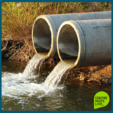
Groundwater saturation occurs when the soil and underlying rock layers are fully saturated with water. This occurrence can lead to several issues, such as flooding where this saturated ground cannot absorb additional rainfall, resulting in surface water runoff and flooding during heavy downpours. Pollution, where excess water can carry pollutants into rivers and streams, affecting water quality and aquatic ecosystems and even strain on current infrastructure; traditional drainage systems struggle to cope with increased runoff, leading to overwhelmed sewers and stormwater drains. They offer the GeoSmart GW5 dataset combining comprehensive data on geology, permeability and historic groundwater levels, it advances data insight to reveal potential susceptibility to groundwater emergence rather than specific risk. This data is available as a PDF or as data to order on interface within a matter of minutes.
SuDS offer an innovative approach to managing surface water runoff while minimising its impact on the environment. SuDS incorporate features such as soakaways, grassed areas, permeable surfaces, and wetlands into the design. These elements help slow down and retain rainwater, allowing it to infiltrate the ground naturally. By diverting water away from traditional sewer systems, SuDS reduce the risk of flooding and pollution. They also alleviate strain on existing infrastructure. Tanks and water butts within SuDS allow for rainwater harvesting and reuse, easing the demand on water resources. SuDS can add a huge value to a development and be deployed to minimise the challenges of maintainability.
SuDS reports should always be considered early in order to inform developers, planners and architects at the early design/concept stage, this equally plays a huge part in supporting civil engineering teams. As a CIRIA member, they offer services that support the Code of practice for property flood resilience (C790F).
You can purchase a full ‘GeoSmart SuDS Report’ for planning applications and property transactions or alternatively start with a ‘GeoSmart SD50’ to identify site suitability for sustainable drainage systems. To discuss your requirements further do call on 01886 832 972.
Policy and directives to ensure effective water management are being taken. Firstly, the UK government has recommended making SuDS mandatory for new developments. This will enhance flood resilience, protect water quality and create greener urban spaces. Local authorities play a crucial role in regulating new developments are now starting to demand Sustainable Drainage Reports as part of the planning process.
These reports assess the impact of proposed developments on water management and recommend appropriate SuDS measures. In addition, the implementation of Schedule 3 to the Flood and Water Management Act 2010 will provide a framework for approving and adopting drainage systems. It will also conditionally link surface water runoff to public sewers based on approved drainage systems. Finally, Defra will conduct consultations on impact assessments, national standards and statutory instruments. These consultations will guide the final implementation of SuDS regulations.

Stay informed about water management practices. They offer accessible location data and reports for individual sites or dispersed assets across the UK. As an Ordnance Survey strategic partner, GeoSmart partner and Apogee partner they provide base maps, flood, drainage and utility data. The goal is to help clients avoid unexpected costs and deliver cost-effective solutions.
Sign up for the newsletter at CentremapsLive to receive updates on sustainable drainage, flood prevention and environmental conservation. Additionally, keep an eye on the blog for an upcoming Professional Discussion with GeoSmart experts.
Remember, responsible water management benefits us all – from preventing floods to preserving our natural resources. Let’s work together for a sustainable future.
Addressing Groundwater Saturation and Sustainable Drainage Solutions

| E | info@centremaps.co.uk |
|---|---|
| W | Visit Centremaps Limited's website |
| Open Space, Leigh Sinton Road, Upper Interfields, Malvern, WR14 1UT |


